Working with Projections
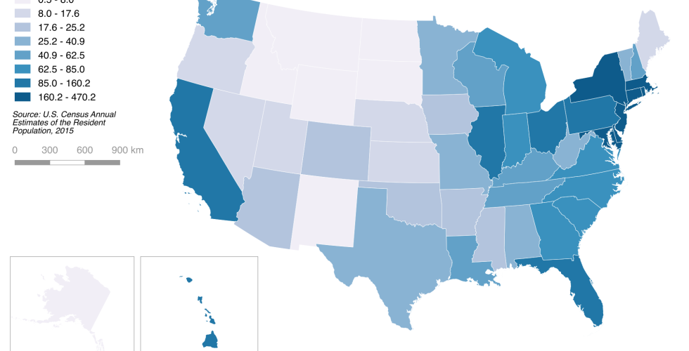
Projections enable us to represent the earth on a flat surface. This tutorial will walk through the process of creating a U.S. population density map in the Albers equal-area conic projection, a standard way of representing the United States with minimal distortion.